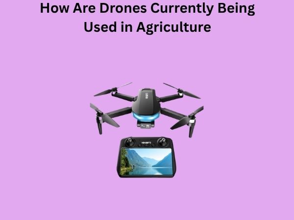
How Are Drones Currently Being Used in Agriculture? Farming from the Sky
Have you ever wondered what happens when cutting-edge technology meets traditional farming? Well, drones are transforming the agricultural landscape in ways that would have seemed like pure science fiction just a decade ago. These unmanned aerial vehicles aren’t just toys for hobbyists anymore—they’re becoming essential tools that help farmers make smarter decisions, save time, and ultimately grow better crops. Let me take you on a journey through the skies of modern agriculture and show you exactly how drones are revolutionizing the way we grow our food.
The Agricultural Drone Revolution: A New Era of Farming
Picture this: instead of a farmer spending hours walking through fields with clipboards and notebooks, a drone equipped with advanced sensors can scan hundreds of acres in minutes, gathering detailed information about crop health, soil conditions, and water distribution. This isn’t just faster—it’s smarter. The agricultural drone market has exploded over the past few years, and for good reason. Farmers are discovering that these flying machines can do so much more than we initially thought.
The shift toward drone technology in agriculture represents a fundamental change in how we approach farming. Rather than relying on guesswork or outdated methods, modern farmers can now make data-driven decisions that directly impact their bottom line. It’s like having a team of expert consultants flying over your fields 24/7, constantly gathering and analyzing information.
Precision Crop Monitoring: Seeing Your Fields Like Never Before
One of the most powerful applications of agricultural drones is crop monitoring. Think of drones as your fields’ personal health inspectors. With high-resolution cameras and multispectral sensors, they can detect problems that would be invisible to the naked eye.
Real-Time Health Assessment
Drones equipped with RGB cameras and multispectral sensors can identify crop stress, disease, and nutrient deficiencies before they become visible problems. This early detection is crucial because catching issues early means you can intervene quickly and prevent catastrophic losses. When a drone spots an area where plants are starting to show signs of stress, farmers can investigate that specific zone rather than treating their entire field.
The technology works by analyzing different light wavelengths that plants reflect. Healthy plants reflect light differently than stressed or diseased plants, and these differences are invisible to our eyes but perfectly clear to drone sensors. It’s like having X-ray vision for your crops.
Identifying Pest and Disease Hotspots
Pests and diseases don’t spread uniformly across fields—they typically start in one area and expand outward. Drones can identify these hotspots while they’re still small and manageable. Instead of spraying an entire field with pesticides, farmers can target treatment to specific problem areas, which saves money and reduces chemical use.
Precision Irrigation: Delivering Water Exactly Where It’s Needed
Water is one of the most precious resources in agriculture, and waste is something no farmer can afford. Drones are changing how we approach irrigation in some pretty remarkable ways.
Thermal Imaging for Water Stress Detection
Thermal cameras mounted on drones can detect temperature variations across fields, which indicates water stress in plants. Plants that are suffering from drought stress actually run warmer than well-watered plants. By flying over fields with thermal cameras, farmers can create precise maps showing exactly where water is needed most.
Imagine trying to find a leak in a massive pipeline by walking along it—that’s what irrigation management used to be like. Now, drones can do the equivalent of running your entire irrigation system through a diagnostic tool, pointing out exactly where water isn’t reaching or where it’s being wasted.
Optimizing Water Distribution
With detailed thermal and multispectral data, farmers can program their irrigation systems to deliver water more intelligently. Some parts of a field might need more water than others due to variations in soil composition, topography, or drainage patterns. Drones help reveal these variations so that water is used where it’s most beneficial.
Crop Spraying and Precision Application: The Flying Applicators
Agricultural drones designed specifically for spraying are becoming increasingly popular, and for good reason. These specialized machines can apply pesticides, fungicides, herbicides, and fertilizers with unprecedented precision.
Reducing Chemical Usage
Traditional crop spraying involves covering entire fields, which means you’re often applying chemicals where they’re not needed. Spraying drones can target specific areas based on data collected during monitoring flights. This targeted approach means farmers can use significantly less chemical while achieving better results. It’s more economical and better for the environment—a win-win situation.
Speed and Efficiency
A spraying drone can cover large areas incredibly quickly. What might take a farmer all day to spray with traditional equipment can be accomplished by a drone in just a couple of hours. This speed is crucial because timing is everything in agriculture. If you identify a pest problem on a Monday morning, you want to spray that afternoon, not wait several days.
Reaching Difficult Areas
Some areas of fields are difficult to access with traditional spraying equipment—think steep hillsides or wet areas that would damage soil structure if driven over. Drones can reach these areas without any soil compaction or environmental damage.
Soil Analysis and Field Mapping: Understanding Your Land Better
Every field is unique, with variations in soil type, drainage, nutrient content, and topography. Understanding these variations is the key to optimizing productivity.
Creating Detailed Field Maps
Drones equipped with GPS and cameras can create incredibly detailed orthomosaics—essentially digital maps of fields at extremely high resolution. These maps serve as the foundation for precision agriculture practices. Farmers can see their fields from perspectives they’ve never had before, identifying patterns and variations that aren’t obvious from ground level.
Soil Sampling Optimization
Instead of randomly collecting soil samples across a field, drones can identify zones with different characteristics. Soil samples can then be collected from these specific zones, creating a much more accurate picture of soil health and nutrient levels. This information guides everything from fertilizer application to crop selection.
Crop Yield Prediction and Analysis: Planning for Success
Knowing what your yield is likely to be before harvest gives you a significant advantage. You can plan storage, arrange contracts, and make decisions about the next season with much more confidence.
Monitoring Crop Development
By flying regular monitoring missions throughout the growing season, drones create a visual record of how crops are developing. Early-season vigor, flowering patterns, and overall growth trajectory all provide clues about final yield. Advanced software can analyze this data and provide reasonably accurate predictions of what you’ll harvest.
Post-Harvest Analysis
After harvest, drones can help analyze what worked and what didn’t. Which fields performed best? Which areas underperformed? This information becomes invaluable for planning next year’s strategy.
Infrastructure Inspection and Farm Management: Beyond Just Crops
Drones aren’t just about the crops themselves—they’re valuable for overall farm management too.
Monitoring Farm Infrastructure
Drones can inspect irrigation systems, drainage ditches, fence lines, and farm buildings without requiring someone to physically walk or drive to these locations. They can identify problems like broken fences, clogged ditches, or equipment that needs maintenance. For large farms, this capability saves tremendous amounts of time.
Livestock Monitoring
For farms that raise livestock, drones equipped with thermal cameras can monitor animal welfare and identify animals that are sick or injured. They can also help with herding and managing animals across large pastures.
Weather Monitoring and Climate Data: Staying One Step Ahead
Understanding local weather patterns specific to your fields is increasingly important as climate becomes more variable.
Hyper-Local Weather Information
While weather forecasts give you general information about your region, drones equipped with weather sensors can provide hyper-local data about temperature, humidity, wind patterns, and frost risk specific to your fields. This level of detail can help you make better decisions about planting, spraying, and harvesting timing.
Data Management and Integration: Making Sense of It All
Here’s where things get really interesting. Drones generate massive amounts of data, but data only matters if you can analyze it effectively and integrate it with your farming decisions.
Software Platforms and Analysis
Modern drone software platforms can process images and sensor data to generate actionable insights. They create visualizations that help farmers understand what’s happening in their fields. Some platforms integrate with farm management software, allowing drone data to inform decisions about irrigation, spraying, and fertilizer application automatically.
Machine Learning and Artificial Intelligence
As drone data accumulates over years, artificial intelligence algorithms can identify patterns that humans might miss. The AI learns which field conditions lead to high yields, which practices reduce disease pressure, and which management strategies deliver the best results for your specific situation.
Cost Considerations: Is Drone Technology Affordable?
Let’s be honest—you’re probably wondering if drones are worth the investment. The answer depends on your farm’s size and situation.
Equipment Costs
Agricultural drones range from relatively affordable models around $5,000 to sophisticated systems costing $25,000 or more. However, costs are declining as technology becomes more common. Additionally, many farmers are discovering that the money saved through more efficient spraying, reduced chemical use, and prevention of crop losses pays back the investment in just one or two seasons.
Service Options
Not every farm needs to own a drone. Many agricultural companies offer drone services—you can hire them to fly your fields for monitoring or spraying. This option makes sense for smaller operations or farms that only need drone services occasionally.
Challenges and Limitations: The Reality Check
Drone technology is powerful, but it’s not a magic solution to all agricultural problems. Understanding the limitations helps set realistic expectations.
Regulatory Restrictions
Drone use is regulated by aviation authorities in most countries. You typically need a license to operate commercial drones, and there are rules about where and how you can fly. These regulations exist for safety reasons and are important to follow.
Weather Dependency
Drones need suitable weather conditions to operate safely. High winds, heavy rain, or low visibility can ground your drone, which means monitoring missions might need to be rescheduled.
Learning Curve
While modern drones are becoming more user-friendly, there’s still a learning curve. You need to understand how to operate the equipment, interpret the data, and translate that data into actionable decisions. Some farmers find it helpful to work with consultants or service providers initially.
The Future of Agricultural Drones: Where We’re Headed
The drone technology in agriculture is evolving rapidly. Several exciting developments are on the horizon.
Autonomous Operations
Future drones will increasingly operate autonomously, following pre-programmed flight patterns and making decisions without human intervention. Imagine your drones automatically flying your fields on a schedule, monitoring crop health, and even applying treatments when they detect problems.
Swarming Technology
Multiple drones working together as a coordinated swarm could cover massive areas even more efficiently than individual drones. This technology is still being developed but holds tremendous potential for large-scale agriculture.
Advanced Sensors
Sensor technology continues to improve, becoming smaller, more powerful, and more affordable. Future drones might carry sensors we haven’t even imagined yet, providing insights into crop health and field conditions that we can’t currently measure.
Getting Started with Agricultural Drones: Practical Steps
If you’re interested in incorporating drone technology into your farming operation, here’s how to start thinking about it.
Assess Your Needs
Do you have specific problems that drone technology could address? Are you dealing with large fields where monitoring is time-consuming? Do you struggle with pest or disease management? Identifying your specific needs helps determine whether drone investment makes sense for your situation.
Research Options
Look into different drone models, service providers, and software platforms. Talk to other farmers who use drones to hear about their experiences. The agricultural industry community is generally good about sharing information and experiences.
Consider Training
Whether you plan to operate drones yourself or hire service providers, understanding how the technology works helps you use it effectively. Many agricultural extension services and drone manufacturers offer training programs.
Conclusion
Agricultural drones represent a fundamental shift in how we approach farming. They’re not just a flashy piece of technology—they’re practical tools that help farmers make better decisions, use resources more efficiently, and ultimately grow better crops with less environmental impact. From monitoring crop health to optimizing irrigation, from precision spraying to infrastructure inspection, drones are proving their value across virtually every aspect of modern agriculture.
The technology is becoming more accessible, more affordable, and more integrated with other farm management systems. While challenges and limitations certainly exist, the trajectory is clear: drones are here to stay, and they’re going to play an increasingly important role in feeding the world’s growing population.
Whether you’re a large-scale commercial operation or a smaller family farm, it’s worth exploring how drone technology might benefit your specific situation. The farmers who embrace these tools early are gaining competitive advantages that could prove decisive as agriculture becomes increasingly data-driven and technology-dependent. The sky isn’t the limit anymore—it’s just the beginning.
Frequently Asked Questions About Agricultural Drones
Do I need a license to operate agricultural drones on my own farm?
In most countries, yes. Even if you’re using drones on your own property, aviation authorities typically require operators to have a commercial drone license or remote pilot certificate. The specific requirements vary by country and region. In the United States, for example, you need a Part 107 license from the FAA. It’s important to check your local regulations because operating without proper licensing can result in significant fines. However, the licensing process is relatively straightforward and doesn’t require extensive training.
How much data do agricultural drones generate, and how do I manage it?
A single drone flight over even a medium-sized field can generate hundreds of high-resolution images and gigabytes of sensor data. This is where software platforms become invaluable—they automatically process this data, organize it, and generate actionable reports. Most modern agricultural drone software includes cloud storage and analysis tools. You don’t need to be a data scientist to use these platforms; they’re designed to translate raw data into visual representations and recommendations that farmers can understand and act on. Many platforms also integrate with existing farm management software to streamline workflows.
Can drones be used for both monitoring and spraying, or do I need separate equipment?
Most farms use different drones for monitoring and spraying because they have different requirements. Monitoring drones need to carry cameras and sensors but can be relatively light and agile. Spraying drones need to be more robust because they’re carrying and dispensing liquid, which affects weight distribution and flight characteristics. Some specialized drones can perform both functions, but they’re usually less optimal at each task compared to dedicated equipment. For most farms, having a monitoring drone and a separate spraying drone makes more sense both functionally and economically.
What’s the typical battery life for an agricultural drone during a monitoring mission?
Most agricultural monitoring drones have flight times between 20 and 45 minutes, depending on the model, payload, and weather conditions. This is usually sufficient to cover 100 to 300 acres on a single battery charge, depending