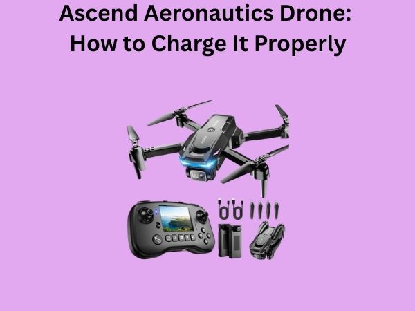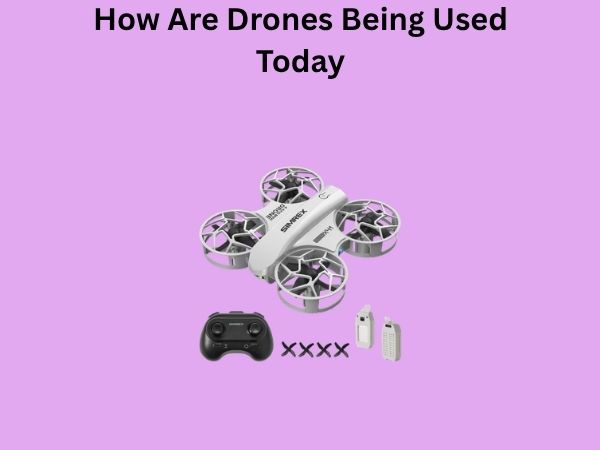
How Are Drones Being Used Today? Surprising Ways UAVs Impact Our Lives
When you think about drones, what comes to mind? Maybe you picture someone flying a quadcopter in their backyard, or perhaps you’ve seen footage from a real estate listing. But here’s the thing—drones have evolved far beyond hobbyist toys and fancy cameras. They’ve become essential tools across industries you might never have considered. From delivering packages to your doorstep to monitoring crops across vast farmland, unmanned aerial vehicles (UAVs) are quietly transforming how we work, live, and solve problems. Let me walk you through the fascinating world of modern drone usage and show you just how deeply these devices have woven themselves into the fabric of our society.
The Evolution of Drones: From Military to Mainstream
It’s easy to forget that drones weren’t always civilian-friendly devices. They started in military applications, primarily for surveillance and reconnaissance missions. What took decades to develop has now become accessible to everyday people and businesses alike. The technology has become smaller, smarter, and significantly more affordable. Today’s drones are equipped with artificial intelligence, advanced sensors, and camera systems that would have seemed impossible just ten years ago.
The shift from exclusive military technology to mainstream tools represents one of the most dramatic technological transitions in recent history. Companies and individuals discovered that the underlying principles could solve real-world problems in completely different sectors. This democratization of drone technology has opened doors we’re still exploring.
Drones in Delivery and Logistics
Imagine ordering something online and having it arrive at your door within hours, delivered by an autonomous flying machine. This isn’t science fiction anymore—it’s happening right now. Major companies like Amazon, UPS, and DHL are actively testing and deploying drone delivery services in various locations worldwide.
Last-Mile Delivery Revolution
The “last mile” of delivery—getting packages from distribution centers to your front door—has always been the most expensive and time-consuming part of logistics. Drones are changing this equation entirely. They can bypass traffic congestion, skip over obstacles, and deliver packages faster than traditional ground transportation. In some areas, drone delivery is already the norm rather than the exception.
What makes this particularly exciting is the environmental impact. Drones consume far less energy per delivery than gas-powered vehicles. If widespread drone delivery becomes standard, we could see a significant reduction in carbon emissions from the logistics sector.
Medical Supply Delivery in Remote Areas
Perhaps even more impressive than commercial package delivery is the humanitarian application. In developing countries and remote regions, drones are delivering critical medical supplies including blood products, vaccines, and emergency medications. These deliveries often reach areas where traditional infrastructure doesn’t exist, potentially saving lives in urgent situations.
Agricultural Innovation Through Drone Technology
If you drive through farmland, you might soon see drones as common as tractors. Modern agriculture is embracing drone technology in ways that are revolutionizing how crops are grown and monitored.
Crop Monitoring and Health Assessment
Farmers are using drones equipped with multispectral cameras to monitor crop health across thousands of acres. These cameras can detect stress, disease, and nutrient deficiencies in plants long before they become visible to the naked eye. By identifying problems early, farmers can take targeted action, applying water, fertilizers, or pesticides only where needed.
This precision approach, often called precision agriculture, isn’t just better for yields—it’s dramatically more sustainable. Instead of treating entire fields uniformly, farmers can now treat specific problem areas, reducing chemical usage and water waste significantly.
Crop Dusting and Spraying
Traditional crop dusting involves low-flying aircraft spreading pesticides across vast areas. Drones are replacing these operations with a more efficient, controlled alternative. Agricultural drones can carry specialized payloads and apply treatments with remarkable precision.
- Reduced chemical exposure for farmworkers
- More accurate application resulting in less product waste
- Ability to treat difficult terrain that’s inaccessible to ground equipment
- Lower operational costs compared to traditional aircraft
Livestock Management
Ranchers are discovering that drones provide an excellent way to monitor large herds across sprawling pastures. Instead of spending hours on horseback or in vehicles checking on cattle, farmers can use drone footage to count animals, check their health, and identify any that might be missing or injured. It’s made ranch management significantly more efficient.
Construction and Infrastructure Inspection
Construction sites have always been dangerous places. Workers need to inspect hard-to-reach areas like building facades, bridge undersides, and tall structures. This traditionally meant sending people up with safety harnesses, which was time-consuming and risky.
Building Inspections and Surveying
Drones equipped with high-resolution cameras can now conduct detailed inspections of buildings without putting workers in harm’s way. They can identify structural issues, cracks, roof damage, and other problems from a safe distance. The data collected can be processed to create 3D models and detailed reports, making inspections faster and more thorough.
Bridge and Infrastructure Maintenance
Inspecting bridges and highway infrastructure used to require closing lanes, deploying work crews, and extensive planning. Now, drone operators can conduct comprehensive inspections in a fraction of the time. They can detect early signs of deterioration, preventing catastrophic failures and extending infrastructure lifespan.
Progress Documentation and Surveying
Construction managers use drones to document project progress and create accurate site surveys. Aerial footage provides a complete picture of ongoing work, helping teams coordinate more effectively and keep projects on schedule. The visual records are invaluable for project management and resolving disputes about completion or quality.
Environmental Monitoring and Conservation
Environmentalists and conservation organizations have embraced drones as powerful tools for protecting our planet. These devices are monitoring ecosystems, tracking wildlife populations, and gathering data that was previously impossible or extremely difficult to collect.
Wildlife Tracking and Population Management
Researchers use drones to observe and count wildlife populations without disturbing them. This non-invasive approach is particularly valuable for studying endangered species, monitoring migration patterns, and understanding behavior in natural settings. The data helps inform conservation strategies and policy decisions.
Disaster Response and Environmental Assessment
When natural disasters strike—hurricanes, wildfires, floods, or earthquakes—drones provide rapid assessment capabilities. They can survey damage across wide areas quickly, helping emergency responders prioritize resources and locate people in need of rescue. After disasters, they’re invaluable for documenting environmental impact and planning recovery efforts.
Reforestation and Habitat Restoration
Some organizations are experimenting with drones that actually plant seeds, speeding up reforestation efforts. These specialized drones can plant trees in difficult terrain or areas affected by wildfires, dramatically accelerating restoration processes that would otherwise take years of manual labor.
Search and Rescue Operations
When someone goes missing, every minute counts. Drones are dramatically improving search and rescue operations by covering ground quickly and providing real-time aerial views of terrain that would be exhausting and time-consuming to search on foot.
Quick Area Coverage
A single drone can survey an area in minutes that might take rescue teams hours to cover on the ground. They can fly over forests, mountains, and water bodies, spotting things that searchers on foot might miss. This capability has already saved numerous lives, particularly in mountainous or wilderness regions.
Thermal Imaging Capabilities
Advanced drones equipped with thermal cameras can detect heat signatures in darkness or through dense vegetation. This technology is particularly effective for locating missing persons at night or in challenging conditions. Rescue teams can now respond with precise locations rather than searching blindly.
Real Estate and Property Management
You’ve probably seen drone footage in real estate listings. It’s become almost standard for high-end properties, but the applications go far beyond fancy marketing photos.
Property Listings and Marketing
Aerial photography and videography have transformed how properties are marketed. Potential buyers can see properties in context with their surroundings, understand neighborhood characteristics, and get a true sense of location advantages. This aerial perspective has become expected by buyers and has actually been shown to increase property values and reduce time on the market.
Land Surveying and Mapping
Real estate developers and surveyors use drones to create detailed maps and 3D models of properties. This data is essential for planning development projects, understanding terrain challenges, and calculating accurate property boundaries. The process is faster and more accurate than traditional surveying methods.
Power Line and Utility Inspection
Power companies and utility providers face an enormous challenge: maintaining miles and miles of infrastructure spread across diverse terrain. Drones have revolutionized how they approach this responsibility.
Infrastructure Maintenance
Inspecting power lines, transmission towers, and utility infrastructure used to require crews working at dangerous heights. Drones can now fly along power lines, inspecting for damage, corrosion, and vegetation encroachment. This reduces risk to workers and allows for more frequent inspections, preventing outages before they happen.
Storm Response and Recovery
After severe storms, utility companies need to quickly assess damage across their networks. Drones can cover vast areas rapidly, identifying downed lines, damaged equipment, and creating repair prioritization plans. This dramatically speeds up recovery and restoration of power to affected communities.
Mining and Quarry Operations
The mining industry has discovered that drones provide unique advantages for operations that take place across challenging terrain and hazardous environments.
Site Mapping and Volume Calculations
Mining companies use drones to create detailed maps of excavation sites and calculate the volume of extracted materials. This data is critical for operational planning, safety management, and reporting. Drones can update this information frequently, providing real-time insights into operations.
Safety Monitoring
Mining is inherently dangerous, and drones help companies monitor operations and identify safety issues without putting personnel at risk. They can inspect work areas, verify safety compliance, and document conditions for regulatory purposes.
Film, Photography, and Media Production
The entertainment industry was one of the earliest adopters of drone technology, and for good reason. Drones have made cinematic aerial shots accessible and affordable.
Cinematic Aerial Footage
Documentary filmmakers, news organizations, and production companies use drones to capture stunning aerial sequences that would have required expensive helicopters in the past. The quality of modern drone cameras rivals professional broadcast equipment, making them indispensable tools in modern media production.
Live Event Coverage
Sports events, concerts, weddings, and large gatherings now frequently include drone coverage. The unique perspectives drones provide add visual interest and professional quality to event documentation. Some sporting events have dedicated drone operators providing real-time aerial coverage for broadcast audiences.
Sports and Recreation
Beyond professional use, drones have created entirely new recreational activities and transformed how we enjoy sports.
Drone Racing
Competitive drone racing is an emerging sport that combines piloting skill, technology, and strategy. Pilots race high-speed drones through complex courses, and the sport has developed professional leagues with significant prize pools. It’s a fascinating intersection of traditional motorsport and cutting-edge technology.
Sports Performance Analysis
Coaches and athletes use drone footage to analyze performance. The aerial perspective provides unique insights into positioning, spacing, and movement patterns that aren’t visible from ground level. This has applications across numerous sports, from soccer to American football.
Weather Monitoring and Research
Meteorologists and climate researchers are deploying drones to gather data about our atmosphere and weather patterns in ways that were previously impossible.
Storm Research
Scientists send specialized drones into developing storms to collect data about wind patterns, moisture, temperature, and other variables. This information helps improve weather forecasting and our understanding of severe weather formation. Some drones can now fly directly into hurricanes and tornadoes, gathering invaluable research data.
Climate and Atmospheric Studies
Long-duration research drones can remain aloft for extended periods, collecting data about atmospheric composition, pollution levels, and climate patterns across different altitudes. This capability has become essential for climate research and environmental monitoring.
Challenges and Considerations
While drones offer tremendous benefits, they also present challenges that society is still working to address. Privacy concerns, safety regulations, airspace management, and environmental considerations are all important topics as drone usage expands.
Regulatory Framework
Governments worldwide are still developing comprehensive regulations for drone operations. These rules balance innovation and practical applications with safety and privacy concerns. Different countries have different approaches, creating a complex landscape for international operations.
Privacy and Ethical Concerns
As drones become more capable and widespread, privacy advocates raise important questions about surveillance and data collection. Clear guidelines about where drones can operate and what they can record are essential for public acceptance and responsible use.
Environmental Impact
While drones offer environmental benefits in many applications, their proliferation could create new challenges. Noise pollution, wildlife disturbance, and energy consumption are considerations researchers are actively studying.
The Future of Drone Technology
We’re still in the early stages of drone adoption and capability development. Emerging technologies like autonomous swarms, extended battery life, improved sensors, and artificial intelligence integration promise even more revolutionary applications.
Urban air mobility—essentially flying taxis and air transportation systems—represents the next frontier. Companies are developing electric vertical takeoff and landing vehicles (eVTOLs) that could transform urban transportation within the next decade. These represent a natural evolution of drone technology scaled up for human transport.
Conclusion
Drones have transcended their origins as military tools or expensive toys to become genuine problem-solving devices integrated across industries from agriculture to emergency response. They’re delivering packages, monitoring crops, inspecting infrastructure, protecting the environment, and saving lives. As technology continues to advance and regulations mature, we’ll likely see drone applications expand into areas we haven’t yet imagined.
The question is no longer “Are drones useful?” but rather “What problem can’t drones help solve?” From the farmer using drones to optimize irrigation in a developing country to the rescue team using thermal imaging to locate a missing hiker, these devices are making tangible differences in how we live and work. As we move forward, the key will be ensuring that drone technology develops responsibly, with appropriate safeguards and ethical considerations, so that the incredible benefits can be realized while minimizing potential drawbacks.
Frequently Asked Questions
What are the main regulations governing commercial drone use?
Commercial drone operations are regulated by aviation authorities in each country. In the United States, the FAA requires Part 107 certification for commercial pilots. Operators must maintain line-of-sight with their drones, stay below certain altitudes, and avoid populated areas. Other countries have similar frameworks, though specific requirements vary. Most regulations mandate that commercial operators complete training, obtain licenses, and follow safety protocols to ensure responsible drone deployment.
How long can a typical commercial drone stay in the air?
Flight duration depends on the drone model and payload. Most consumer and professional drones can remain airborne for 20 to 55 minutes on a single battery charge. Specialized drones designed for long-duration missions can stay aloft for several hours, and some experimental models have achieved flights lasting over 24 hours. Battery technology continues to improve, which will extend flight times as the industry matures.